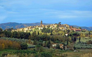
We leave Buti sport field parking and we’ll going up along Monte Aspro slopes, before through an aspalth road (out 2 KM) and after through a path (‘carrareccia’) ,which is within a pine forest, until the crossroad in Loc. l’Aspro, the panoramic view on Buti valley.
We’ll move on in climb, along the right path until Volpaia Colle, after that we’ll take the left path and we’ll going up Monte Gentivola, walking along Piavola, then we’ll go along Piambello and just out from the wood, we’ll be in front of in a panoramic view, from where we can admire Valdera.
Piavola-Il Sorbo
Itinerary continues until meeting Monte Serra country road, from whom we’ll go for 2 km in descent, until to arrive hairpin turn where on the right starts a ‘pista forestale’ and leading in loc. Il Sorbo (435 m s.l.m.) .
In this suggestive area there are some relays about “Strada Dell’olio Dei Monti Pisani” and different educational trail ,with the possibility of rest area.
From here is possible go along a path that leading to Prato a Giovo, going through Certosa and Montemagno.
Il Sorbo-Quadonica
From Il Sorbo we’ll go along ‘pista forestale’ going through Quadonica for about 2 Km, after that, on the left starts a path in descent, it arrives on the road in Mariotto and below goes to Buti (borgo Castel Tonini, sede della Villa Medicea).
Quadonica-Buti
The itinerary goes inside country historical center until to reach the start point, going through Garibaldi square, Martiri della Libertà square and going along Danielli park.
Technical details:
Start point: BUTI SPORT FIELD PARKING
Start share: 127 m s.l.m.
Arrival share: (Loc il Sorbo): 435 m s.l.m.
Maximum climb: 490 m
Distance: circa 16 Km
Mean time of journey: 6 h-7h
Difficulty: medium- easy
Note: For people who says they can walking for long path
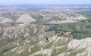
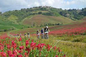
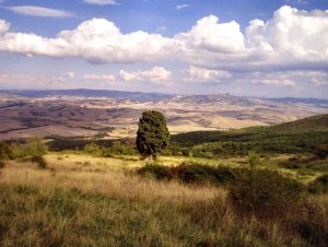
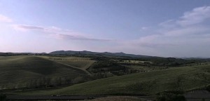
The excursion is characterized by various types of environments; we pass from a wooded environment, we pass from a typical Tuscan countryside, It’s characterized by hills alternated by watercourses.
During the excursion we can find a typical Tuscan farms, They are sometimes accompanied by the characteristic double to spin of cypresses.
You have to leave the car in the car park of the agritourism “Le Valli”, a cross will guide us to the path.
Attention: Since It is not possible to know the number of participants of the longer path, If the group will be numerous,the group could arrive late, in that case who was waiting the group, he/she can visit Rivalto.
Technical Details
Stroll in the Woods of Rivalto – Casciana Terme (Pisa) Duration: 6/7 h Itinerary: Agritourism Le Valli – Rivalto – Casciana Terme – poggio alla Farnia – Collemontanino – Agritourism Le Valli
Organized by CAI LIVORNO Rate non-registered: 10,00 € Meeting: 9.15 Agritourism Le Valli
It will possible to have lunch at the end of path Agritourism Le Valli -Departure and arrival. Menu: 18,00 €
Head of excursion: Massimiliano Scavo tel. 347 6045212
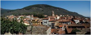
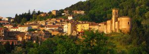
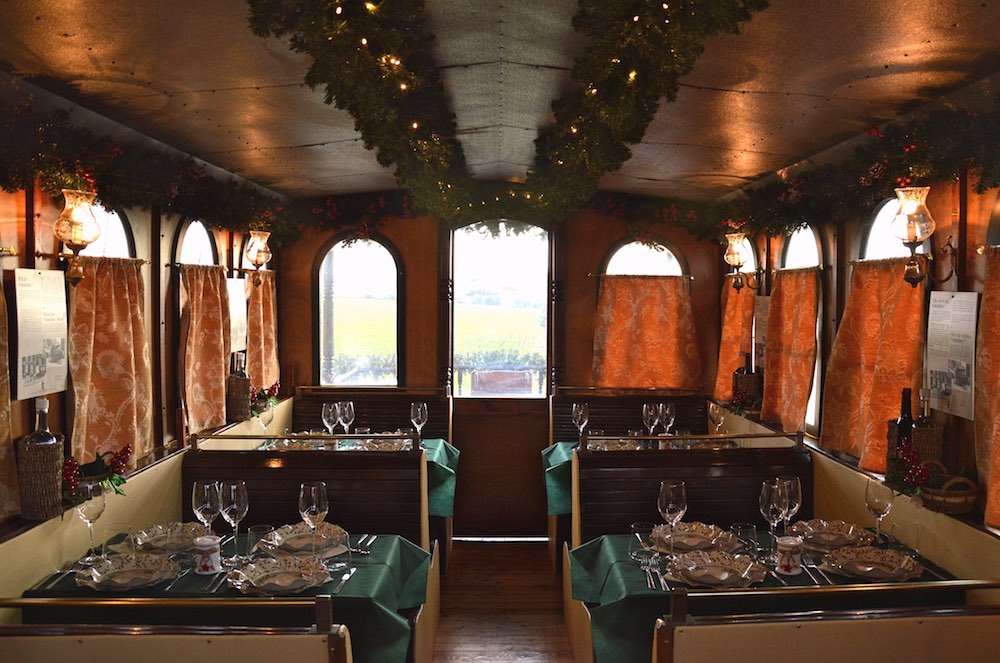
Torre a Cenaia farm is a Pitti family’s ancient property in the Tuscan countryside. It houses a natural and wonderful scenery in which you can taste typical Tuscan products.
Though a scenic street we reach parco giardino all’Italiana with its impreziosito .
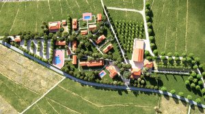
The farm is held on 500 hectares, characterised by small lakes, VITIGNI and a part of forest.
There are 30 hectares of many types of grape: Sauvignon-Blanc, Chardonnay, Vermentino, Trebbiano, Sangiovese, Syrah e Cabernet-Sauvignon, with a particular attention for the protection of the environment.
Visit
The first step is the explanation about the history of the farm with the visit at the church, with an unknown old painting. Then, when we are goin to explain the species which populate the small lakes and the forest and its habitat.
Men work in the vineyards the whole year, so during the tour the procedures of the plant’s growth in order to provide to the visitor a complete version about all the proceedings during the year. The tour goes on with the arrival to the farm and its vineyard of white wine such as Sauvignon-blanc, Chardonnay, Trebbiano e Vermentino. This last type of wine is the symbol of the farm. The visit ends with a wine tasting where the hosts are introduced in a gastronomic world that makes you feel the real taste of the Tuscan wine.
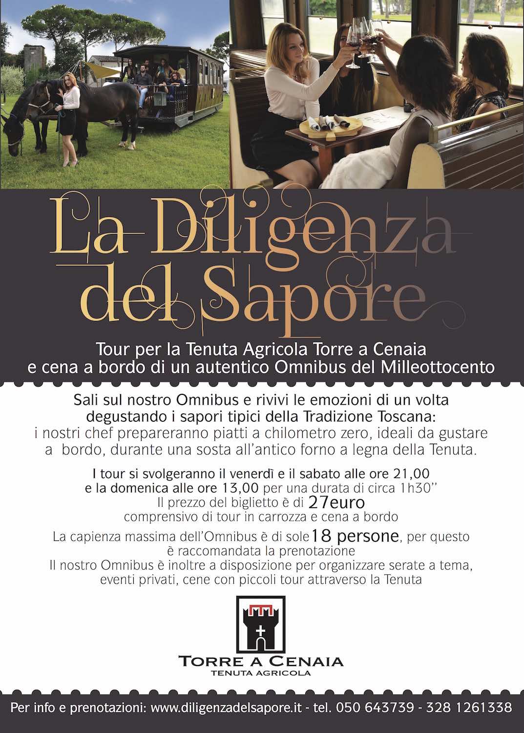
Moreover, the farm offers tastings for wines, beers, typical products, tour in carriage with lunch or dinner on board of an ancient Omnibus; guided visits to cellars and basements.
You can reach the farm in a 20 minutes drive from Livorno or Pisa, about an hour drive from Florence. You have to follow the directions towards Cenaia – Strada del vino delle colline pisane.
The farm houses a big car park for cars, minibus and coaches.
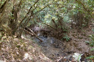
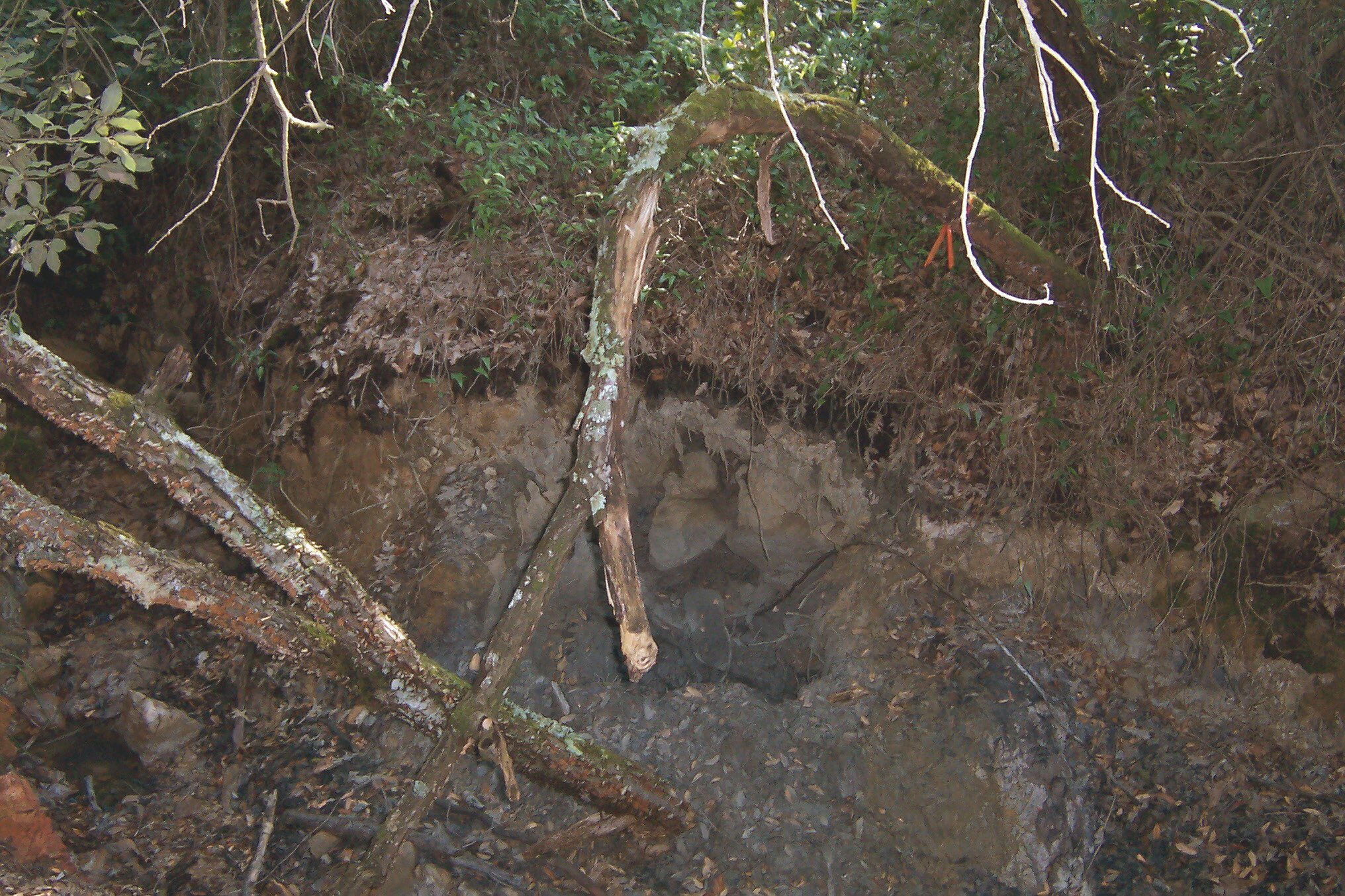
The Mofeta of Borboi
The study of the ecosystems of the mofetes – the spillages of carbon dioxide from volcanic rocks is began some years ago, It has led some scientific results and it has reevaluate the natural environment.
In particular the Mofeta of Borboi in the neighbourhood of Orciatico has led a numerous groups of scientist from all over the world.
It is interesting because it allow to appreciate the realistic effect of carbon dioxide in the future.
The Mofeta is about 1 Km in North of Orciatico, It’s visitable and reachable from a path.
Path of Mofeta of Borboi
Type of path: enviromental, naturalistic, scientific
Lenght: 1,4 Km from the North of Orciatico, 5,5 Km from the South of Lajatico
degree difficulty: easy
From Orciatico: If you have left the provincial street to Lajatico, The first 500 meters are accessible on foot, The last path is about 200 meters and it’s accessible on foot.
From Lajatico: Drive to Orciatico, then as above.
Time taken: from the provincial street to Lajatico 15 min. on foot
Leaving from Peccioli , we go down the steep via di Greta. In less than a kilometer we get to the gravel bed of Era River characterized by spontaneous vegetation, large and rich variety of birds.
So we continue along the river up to the Molino di Ripabianca . From Le Piagge, where the suggestive vision of tuff cliffs that run along the municipal road Peccioli-Fabbrica follows us on the left, we can make a road variation of up to Ripabianca , to be used in case of flooding of the river.
After approximately four kilometers we start to go up to reach the municipal road with which we reach the charming town of Montecchio and continue, still with the dirt road, in the countryside of the area of Serre, which has varied crops and is natural habitat of various game species. There are two ways of traveling to this area; one is from Costie and the other takes you back to Peccioli through the road of Madonna delle Serre , named after the namesake church in this area, and characterized by a fresh and hospitable little forest, place of pilgrimage the first Sunday of May.
EVENT
Randonnée ARI patent, Randonnée Mountain Bike patent.
INSPIRATION
The event, in line with the directives of ARI, will pursue the following purposes: self-sufficiency, affordability, simplicity, security, contact with nature.
The event was inspired by the slow travelling on nature trails
ORGANIZATION
The ownership of the event is the GSRC Galimberti, with the patronage of the Municipality of Pontedera and the collaboration of G.S. Treggiaia, POL la Perla “Razzi e Mozzi” and Borra Bike with ARI audax randonnée Italy.
The event will adopt the Regulation ARI / MTB.
THE EVENT
DATE
Sunday, August 31st, 2014.
Preliminary checks from 07.00 to 08.00 at the Club Galimberti in Via Galimberti, Pontedera.
Start from 8:00am to 08.10am from GSRC GALIMBERTI.
WHO CAN PARTICIPATE
Cyclists and cycle tourists members with papers in order for the year 2014 ARI, or bodies recognized by CONI UISP; ACSI; CSAIN; ASI; CSI; ENDAS; FITRI, and also free hikers equipped with medical certificate, bike Mountain bike and helmet (mandatory). after filling the release paper ARI.
REGISTRATION
We accept MAX 300 people. The registration fee is € 10.
Entries close automatically when we reach the number of 300 paying cyclists, there is no possibility of pre-registrations.
Registration opens from June 20th, 2014 at the Club Galimberti in Via Galimberti n° 4, Pontedera. – or online via the website www.audaxitalia.it (REGISTRATION)
Registration fee: (10 €) to be paid by bank transfer before you sign up.
Description of payment (“causale”): you have to write “Iscrizione Randonneè della valdera.”
Account name: G.S.R.C Galimberti.
Bank: “Banca di Pisa e Fornacette”.
Bank account details: IBAN – IT37 Z085 6271 1310 0001 0375 939 – SWIFT BIC: BCCFIT33
Registration deadline Sunday August 31st, 7.30am
We recommend the use of RandoCard ARI (cyclist card ARI) to sign up, the preparation of the release of responsibility, which will have to be delivered to the preliminary checks, the validation steps at the start, the control places along path and at the finish.
RACE DOCUMENTS
Road Book route map with street guide (town refreshments and fountains), Paper ARI / MTB / RG as travel validation step in places of control. GPS path track.
THE ROUTE
40 / 70 / 115 km, short, medium and long, as for the ARI / MTB standards.
The “randonnée valdera” will make a great added value to the event, as it allows cyclists to follow paths and roads of GPN and horse trail through hills, woods and streams.
The route is marked as “Randonnée valdera”.
NB: Hikers enrolled arriving at the refreshment / control “LE SERRE” after 13:00pm will not be allowed to continue in the long route.
“We remind that the long path requires a good physical condition.”
Refreshments:
There are 4 food spots on the path next the checkpoints. (Terricciola, Le Serre, Castelfalfi and Legoli) – and a pasta party at the finish.
RECOGNITION
The GSRC Galimberti will distribute to all the cyclists who will get the approval ARI / MTB (40 – 70 – 115 Km) a scroll by the artist Giancarlo Calamai reproducing the logo of the event.
STREETS GUIDE
Roads / dirt roads of Randonneè:
A) PONTEDERA starting 8:00-8:10am from Via Galimberti – towards Ponsacco on the bike path parallel to via roma – underpass in Viale Europa – the street in front of cemeteries – bike path until “La Borra” – path levee Era River.
A) PONSACCO (time 8:15 to 9:15) Trail embankment ERA – via Melegnano – Viale Primo Maggio – via xxv aprile – Via Roma via dei mille – via cesare Battisti – via Era – Roundabout – dirt road to Camugliano.
A) CAPANNOLI (hours 8:45 to 9:45) via Camugliano – dirt road near “Solaia” – via delle pinete – via provinciale 26 – via del Pino – dirt road up to via dei Pontini – via delle case – dirti road via dei monaci – via di badia.
A) TERRICCIOLA (9:15 to 10:30 via di badia – dirt road via taneto – via della cascina – via terricciolese –
Via Bagno “A / R” – (First Food Spot.) dirt road via delle colline.
A). CHIANNI. Dirt road via delle colline – strada provinciale 14 “Miemo” –
A). LAJATICO (10 am – 11.30 am) “Fontanelle” . Dirt road from strada provinciale 14 to strada provinciale 45 – Via Pietro Nenni – unpaved local road via dell’uccelliera “theater of silence” – via Volterra SR 439.
A) PECCIOLI / MONTAIONE (11am – 13:30)
SR 439 – gravel road lake Gattero – municipal road of Montelopio – via di mezzo – Fabbrica – via della chiesa / towards Fabbrica – via delle case nuove – Montecchio – via Aldo Neri – dirt road, via madonna delle serre (2nd Food Spot). – GPN dirt road up to strada della bonifica – via della bonifica – via della bonifica gravel road towards Castelfalfi – dirt road and golf courses. – Castelfalfi (3rd Food Spot) Via SP 26 – via di mezzo / via Poggetta – via di monti – dirt road GPN towards via Libbiano Legoli -.Legoli – (4th Food Spot).
A) PALAIA (12.30 – 15:00) via SP 11 – dirt road up to municipal road Toiano – via Toiano – dirt road collelungo (agliati) until SP36 – Chiecinella – dirt road via della costa towards Marti.
A) MONTOPOLI (13.30 – 16:00)
Via della costa – via fontanelle – via della croce – MARTI – (WATER SPOT) via Mazzana – Varramista – via di ricavo – highway underpass – Castelbosco – dirt road via val di frigoli – via della falce.
A) PONTEDERA (-13 hours – 18) via della falce – municipal road Palaia / La Rotta – via del pietriccio – via di montecastello – cycle path of Braccini lakes – via Enrico de Nicola – cycle lane in Viale Italia – back, through cycle path, in the Era river embankment – arrival via galimberti.
R) FROM TERRICCIOLA (return on short course) – time 10:30 to 11:30 the road of Chianti towards Morrona – Stibbiolo – via dei cipressi – San Pietro Belvedere – via vignoli – via Corsica – provincial road 26 via san rocco – dirt road for Solaia – via Camugliano – Ponsacco – cycle lane on levee Era river – arrival via Galimberti.
R) FROM PECCIOLI (return middle course) (11:00 – 13:30) from madonna delle serre – Municipal road poggio al pino – provincial road 41 – via San Sebastiano – via dei cappuccini – cycle path towards Forcoli – via la bianca – via SP26R, via di santo pietro belvedere – sarzanese valdera – via Baciocchi – Piazza Castello – via san rocco – dirt road under the cemetery towards Camugliano – via Camugliano – via valdera – cycle lane levee Era river – arrival via Galimberti.
A) roads of the long route R) roads of return short and medium course.
Here you can see the video made for the 2014 edition:
The G.P.N. is a route that winds through the province territory for more than 100 km, it sets up a network connection for all activities of trails, and horse trail that facilitates the visit and the activities in our territories.
You can spend extraordinary days of touring following the state highway Sarzanese that runs through the Valdera from Massa Marittima to Pontedera . From the beautiful old town of Massa Marittima you take the state highway 439 , called “Sarzanese” towards the North to Monterotondo Marittimo.
In Monterotondo Marittimo there is the very charming Park Biancane in which the force of nature shows itself in the form of steam emissions from the ground, fumaroles and geothermal wells. Again on the Sarzanese, you can reach the medieval town of Castelnuovo Val di Cecina where you must walk in the old town centre and pass the Chiassino the alley which, with its 50 cm. width, is the narrowest street in the world.
Just beyond Castelnuovo Val di Cecina, on the right there is the town of Larderello where you can really get surprised watching the giant geysers . Back on the main road 439, we go up towards Pomarance where you can enjoy beautiful views over the Cecina Valley. A bit forward the town of Saline manages to offer some beautiful views of the nearby Volterra .
With gentle bends and ups and downs, the Sarzanese leads us first to Capannoli, then to Ponsacco and eventually in Pontedera.
The tour aims to select a portion of precious kilometers of the long and sometimes monotonous SS / SR439 Sarzanese Valdera. The official route would start from Pietrasanta, this is only a summary, which starts the engine in La Sterza and brakes in Massa Marittima. Consider it as a Best Of.
Choosing a starting point, for the sympathy we light the engine in La Sterza: although after a turn on the right, the following kilometers run virtually with straight handlebars. To warm up the tires we have fun in the ups and downs with pit-stop at the village of Lajatico , birthplace of the famous tenor Andrea Bocelli . The relaxing stop is at the Theatre of Silence : a natural amphitheater with a rich musical and cultural program.
start/end: from La Sterza to Massa Marittima lenght: 70km durata: 1 giorno type of road: mix, hills, mountains provinces: Pisa, Grosseto
Utilizzando il sito, accetti l'utilizzo dei cookie da parte nostra. maggiori informazioni
Questo sito utilizza i cookie per fonire la migliore esperienza di navigazione possibile. Continuando a utilizzare questo sito senza modificare le impostazioni dei cookie o clicchi su "Accetta" permetti al loro utilizzo.